Record-breaking rainfall extremes are becoming more frequent in a warming climate, particularly intense short-duration events that often lead to pluvial (or flash) flooding in urban areas.[1] This increase can be attributed to the ability of a warmer atmosphere to hold more moisture as well as variations in regional weather patterns.[2] At the same time, urban expansion has occurred at a rapid pace across the world in recent decades. This growth of impervious surfaces, along with inadequate or aging floodwater drainage systems, means that an increasing proportion of the world’s population is at risk of urban flooding.
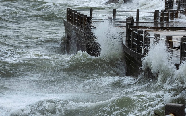
In 2023, several urban regions around the globe experienced severe flash flooding, with two notable instances being New York City and Hong Kong. These events epitomized the pressing challenges that urban populations face in adapting to climate change. Both cities, each home to around 7 million to 8 million people, saw record-breaking rainfall over a short period that overwhelmed infrastructure and led to questions about their readiness to manage flood risks in a warmer world.[3],[4]
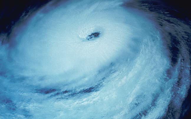
In September 2023, New York City was hit by an exceptional rainfall event that resulted in widespread flash flooding. The remnants of Tropical Storm Ophelia merged with a mid-latitude weather system off the northeastern U.S. coastline on September 28. This confluence then stalled over New York City for 12 hours, leading to an extraordinary deluge.
Precipitation totals of over 200 millimeters were recorded at many locations within just a few hours on the morning of September 29. Queens, Kings and Nassau counties were among those recording the highest totals.[5] Notably, John F. Kennedy Airport registered nearly 220 millimeters of rainfall in a single day, surpassing all previous records at the site.[6] Neighboring areas in the states of New Jersey and Connecticut also experienced severe flooding.
In New York City, the flooding disrupted public transportation, with subway and train services suspended and several highways closed. Governor Kathy Hochul declared a state of emergency for five boroughs, and the New York Army National Guard was deployed. The flooding also led to partial roof collapses, inundated basements and overwhelmed sewers. It is now the third time in two years that New York has seen severe pluvial flooding, following the devastating impact of post-tropical cyclone Ida in 2021.[7]
Earlier in the month, Hong Kong experienced a similar situation, when the remnants of Typhoon Haikui stalled over the Pearl River Delta between September 7 and 8. The low-pressure system interacted with the seasonal monsoon, depositing huge amounts of precipitation over Hong Kong and the broader Pearl River Delta area. This event marked the heaviest rainfall recorded in Hong Kong since records began 140 years ago. The Hong Kong Observatory recorded over 600 millimeters of rainfall within 24 hours, with parts of Hong Kong Island receiving over 800 millimeters,[8] far exceeding the city's average September rainfall of around 320 millimeters.
The overall impact of the floods was devastating, with 15 fatalities (four in Hong Kong and 11 in Guangxi). Like New York City, infrastructure was overwhelmed. Shopping malls and underground railway stations were deluged. Landslides also occurred, with large boulders tumbling down roads and causing significant damage. The government declared that the city was under “extreme conditions,” advising employers that nonessential workers should not be required to report for duty.
Around the world, cities continue to grow in terms of both population and spatial footprint. A recent study led by the World Bank found that between 1985 and 2015, the built-up area across the world grew by 85%, from 693,000 to over 1.28 million square kilometers.[9]
| No risk | Low risk (<0.15m) | Medium risk (<0.5m) | High risk (<1.5m) | Very high risk (>1.5m) | Extent of global settlement (km2, millions) | |
|---|---|---|---|---|---|---|
| 1985 | 64.2 | 17.8 | 8.1 | 5.5 | 4.3 | 0.69 |
| 2025 | 64.3 | 17.8 | 8.7 | 6.1 | 5.2 | 1.28 |
| Change | -1.9 | 0 | 0.6 | 0.6 | 0.9 | 0.59 |
At the same time, the proportion of urban areas at low risk of all types of flooding (pluvial, fluvial and coastal) decreased by 1.9 percentage points, while the percentage of settlements in areas classified as high or very high flood risk increased (Table 1).
This urban expansion in high-risk flood zones is being largely driven by developing nations, particularly in East Asia, where the rate of growth in areas susceptible to flooding is 60% faster than in areas with lower flood risks. In many cities, such as Da Nang in Vietnam, this growth is being fueled by construction on land that has been reclaimed from waterways or the sea.
Urban expansion is only part of the story, however, with inadequate or aging drainage also playing a role. Take New York City as an example: Like many major cities, it has a stormwater drainage system built to manage only moderate-intensity rainfall events. The city's standard design criterion is aligned with a storm that has a five-year return period, equating to 44 millimeters per hour.[10]
Hong Kong is in a better position; it experiences heavy rains every summer, and the main trunks of the urban drainage system are designed to withstand events between 1-in-50 and 1-in-200 years.[11] However, as we saw in 2023, this does not mean that disasters beyond the design return period will not happen. Overall, these events highlight the need for stormwater drainage systems that can better cope with severe rainfall events in a warming world.
The challenge of flash flooding and inadequate drainage systems can be proactively managed through the introduction of resilient urban design concepts. One such strategy that has gained traction in recent years is “sponge cities.” This concept has been developed in different ways around the world: sustainable urban drainage systems in the U.K., bluegreen infrastructure in the Netherlands, low-impact development in the U.S. and Canada, and sponge cities in China.
There are some differences between the techniques, but generally they seek to slow the response of urban catchments to reduce the peak of urban runoff and improve water quality. Most of the systems also seek to harness natural processes to a greater or lesser degree to achieve these aims.
Some of the systems are heavily engineered involving pumped storage systems, such as Happy Valley in Hong Kong, (Figure 1) which may then reclaim water for reuse. Others are more nature-based, such as in the U.K. (Figure 2) using constructed wetlands as “treatment trains,” which return cleaner water to the natural environment.


Source : Susdrain
With escalating flood risks and future urban planning needs, the demand for high-resolution flood modeling tools is increasing. One such tool is CityCAT, developed by a WTW Research Network partner, Newcastle University.[12] CityCAT is a state-of-the-art flood modeling system well suited to simulating urban flood risk at a spatial resolution of up to 1 meter and has been used in a large number of European cities. It can represent flow pathways, water depths and velocities for all types of flood events. Such high resolution modeling is required in urban areas to more realistically reflect the intricacies of the urban environment, such as subsurface drainage, buildings and terrain.
Importantly, CityCAT can also explicitly represent sponge concepts, such as impermeable areas and green areas. Indeed, the model has recently been configured to optimize the selection of sites to aid city planners in deciding where best to retrofit or add new drainage infrastructure.
Cities around the world are responding to an increase in risk and vulnerability with a variety of approaches. However, even the most recently built modern city will struggle to meet the challenges of legacy systems and a changing climate. As a result, designing or retrofitting systems to fail in a controlled and predictable manner to minimize damage may be the only option in some cases.
For insurers, understanding changes in hazard as climate change unfolds is increasingly important. But even more so is understanding exposure and vulnerability. Realistic city flood models, at high resolution, with storm sewers and defenses are required for this. With 80% of global GDP generated in cities, and projections indicating that 70% of the global population will live in urban areas by 2050,[13] city flood models will become an increasing priority for insurers and other risk managers.
Chris is Director of Civil and Geospatial Engineering and Professor of Hydrology and Climate Change in the School of Engineering at Newcastle University.